

Rombalds Moor [Ilkley Moor]
Good walks are even better shared.
SE1145 : Footpath repairs
John Illingworth Photo source
Overview
Rombalds Moor [Ilkley Moor] is a 402.5 m Marilyn in West Yorkshire. Its summit is beside a trig pillar on the high moor, beyond the Cow and Calf rocks and Twelve Apostles stone circle. Paths from Ilkley cross heather, gritstone and peat, with steep steps, boggy patches and broad views over Wharfedale.
Rombalds Moor [Ilkley Moor]
Rombalds Moor rises between Wharfedale and Airedale in West Yorkshire. Ilkley Moor is its northern, town-facing part. The hill recorded by the Database of British and Irish Hills is 402.5 m high, with 245.5 m of prominence, and qualifies as a Marilyn.
Finding the summit
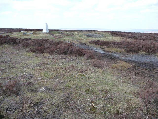
The summit is the ground beside the trig pillar at SE114452, just off the flagged high-level path. DoBIH records possible highest ground a few metres north and northwest of the pillar. The Twelve Apostles stone circle, Cow and Calf rocks and White Wells are separate landmarks; visiting them does not by itself reach the summit.
The moor combines heather, grass, peat and gritstone outcrops. Broad views include Wharfedale and the surrounding Pennine landscape, depending on visibility. The underlying Carboniferous sandstone and shale, later shaped by ice and landslips, help explain its crags and wet ground.
Summit walks
The Friends of Ilkley Moor's White Wells circuit climbs via White Wells and the stone steps to the Twelve Apostles, then heads west to the trig point. It continues past the Stanza Stones and Thimble Stones and returns on Keighley Road to White Wells car park. The guide suggests about two and a half hours.
For a Cow and Calf start, the Get Lost Mountaineering circuit is 10 km, with a published estimate of three to four hours. It takes in Ilkley Crags, the Apostles, summit, Thimble Stones and Whetstone Gate, then returns from Keighley Road across Ilkley Crags to the rocks and original car park. Stay back from the sheer rock edges.
Bradford Council's Length and Breadth of Ilkley Moor walk is an 11.2 km circuit from Wells Road car park beside Darwin Gardens. Its western approach visits the Swastika Stone, Crawshaw Moss and Buck Stones before crossing the summit and descending through White Wells. The leaflet's shorter 9.2 km option turns down at Whetstone Gate and does not visit the summit.
The Great Outdoors publishes a different White Wells circuit: 9.4 km, 290 m ascent and four hours. It includes the summit and a Badger Stone detour, returning by the paths around Spicey Gill and White Wells. Its figures apply to that complete route.
The Rombalds Stride is a much longer organised winter challenge. The organiser's published route is 23 miles, about 37 km, starting and finishing in Guiseley and crossing Baildon Moor, Rombalds Moor and Otley Chevin. It does not finish in Ilkley. The published ten hours is an event cutoff, not a normal walking-time estimate; consult the organiser for the current route, access arrangements and entry requirements.
Heritage and access
The Twelve Apostles is a scheduled Bronze Age stone circle on Burley Moor, east of the summit. Its stones have been re-erected, so the present arrangement should not be assumed original. The wider moor also has prehistoric rock carvings. White Wells developed around spring-water cures in the late eighteenth century, and Ilkley's council bought the moor in 1893. Local stories associate Rombald with a giant; that is folklore rather than a proven name derivation.
Use the Wells Road/White Wells car park or the public Cow and Calf car park appropriate to your route. Ilkley railway station has Northern services from Leeds and Bradford Forster Square; check the current timetable and walk uphill through town to the moor. White Wells refreshments depend on opening; the flags indicate when it is open. Carry food and water for the walk.
Moorland care and safety
Expect steep steps, uneven rock, boggy patches and slippery paving. Wind and mist can make the exposed moor harder to navigate, and ice increases the risk on steps and rock. Carry a map and compass and suitable waterproof clothing, and stay clear of crag edges.
Ilkley Moor is protected for its moorland and blanket-bog habitats and birds. Follow existing paths, leave carved rocks and standing stones undisturbed, and take litter home. Bradford Council asks for dogs to be controlled, with leads around livestock and during March to July. Do not light fires or barbecues. Access arrangements on neighbouring privately owned moors can differ. For a hill emergency call 999, ask for Police, then Mountain Rescue.
Explore routes near Rombalds Moor [Ilkley Moor]
Walks starting near this hill. Open a route to check its map, distance and full itinerary.
St Ives Reservoir and Water Garden Loops
View route
Silsden to Kildwick Canal Walk
View route
Saltaire to Bingley Five Rise Locks
View route
Bolton Abbey: Strid Wood and Barden Bridge Circuit
View route
Route planning notes
These notes describe possible approaches. Check a route's map and access information when planning your walk.
Cow and Calf, Twelve Apostles and summit circuit
From Cow and Calf car park, pass the rocks and climb via Ilkley Crags steps to the Twelve Apostles. Retrace to the flagged path and head west to the summit trig, Thimble Stones and Whetstone Gate. Descend Keighley Road, then turn east above Spicey Gill to cross Ilkley Crags and return via the Cow and Calf to the car park. Allow about 3-4 hours; keep back from the rock edges.
White Wells, Twelve Apostles and summit circuit
Start and finish at White Wells car park on Wells Road. Climb past White Wells and up the steep steps, then follow the moor path to the Twelve Apostles. Return to Lanshaw Lad and turn west along the flagged path to the summit trig. Continue past the Stanza Stones and Thimble Stones to Keighley Road, then turn right and follow the road downhill to the car park.
Rombalds Stride: Guiseley challenge circuit
The organiser's 23-mile circuit starts near West Side Retail Park, Guiseley, via Esholt, Baildon Moor and Weecher to the Twelve Apostles and summit trig. It continues via Whetstone Gate, Pipers Crag, Ilkley, White Wells, Cow and Calf, Burley Woodhead, Menston and Otley Chevin, finishing at Guiseley Scout HQ. This is an organised winter challenge; its 10-hour event cutoff is not an estimated walking time. Check the organiser's current route and entry rules.
Length and Breadth of Ilkley Moor summit circuit
Bradford Council's full circuit starts and finishes at Wells Road car park beside Darwin Gardens. Walk via the Swastika Stone, Pipers Crag, Crawshaw Moss and Buck Stones to Whetstone Gate. Continue east past the masts, Thimble Stones and summit trig to Ashlar Chair, then descend via Ilkley Crags steps and White Wells to the car park. The leaflet's shorter 9.2 km return from Whetstone Gate misses the summit.
White Wells summit and Badger Stone circuit
Start at the Wells Road car park below White Wells (SE115470). Climb via White Wells and Ilkley Crags to the Twelve Apostles, then head west past the summit trig and Thimble Stones to Whetstone Gate. Descend Keighley Road, detour to Badger Stone, retrace to Grainings Head, then follow the Spicey Gill paths back via White Wells to the same car park. The Great Outdoors guide gives 290 m ascent.
Make a day of it, together
Find someone to share the walk with, or organise a day out along a route you like.
Photo Gallery
View all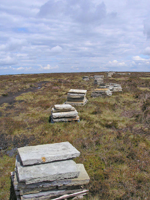 Photo could not load
SE1145 : Footpath repairs
John Illingworth
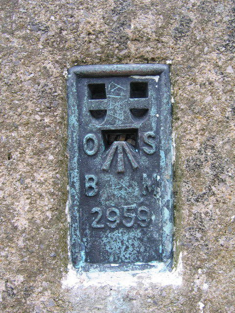 Photo could not load
SE1145 : Trig Point Benchmark
DAVID JOHN SHERLOCK
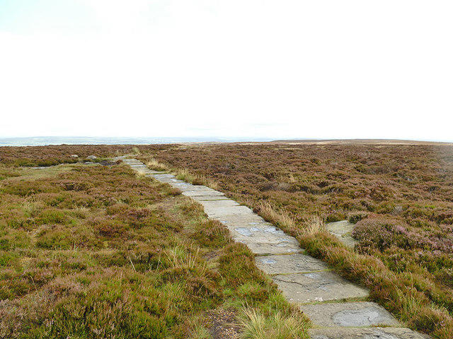 Photo could not load
SE1145 : Causeway on Ilkley Moor
Stephen Craven
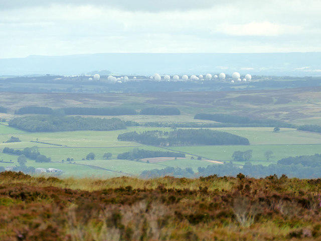 Photo could not load
SE1145 : View from Ilkley Moor to Menwith Hill
Stephen Craven
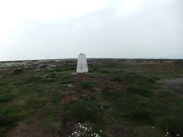 Photo could not load
SE1145 : Trig pillar, Rombald's Moor
David Brown
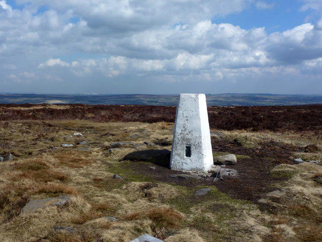 Photo could not load
SE1145 : Rombalds Moor trig point 402m/1,306'
John H Darch
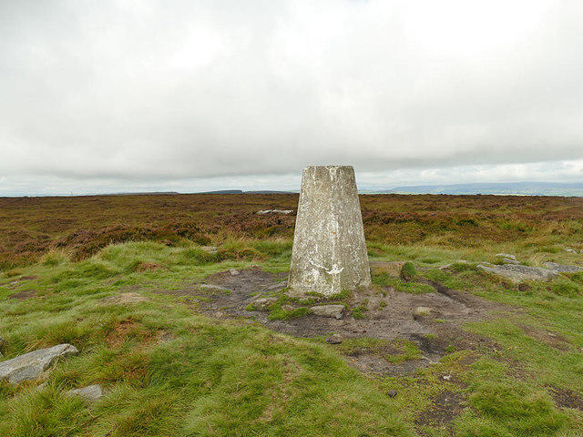 Photo could not load
SE1145 : Trig pillar and cairn on Ilkley Moor
Stephen Craven
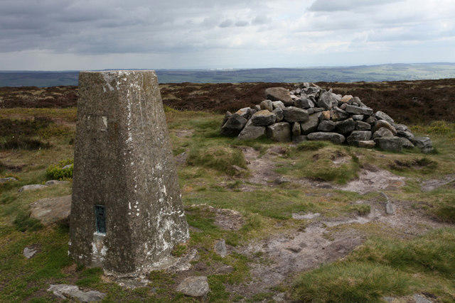 Photo could not load
SE1145 : Rombalds Moor Trigpoint
Andrew Whale
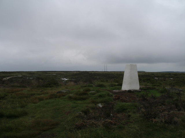 Photo could not load
SE1145 : Rombalds Moor trig point
John Slater
SE1145 : Rombalds Moor trig point
Christine Johnstone
Hill facts and local notes
Classifications
Elevation
402m
1,321 ft
Prominence
246m
Coordinates
53.9031, -1.8269
SE114452
OS Map
104
Explorer: 297
At the Summit
Ground beside the trig pillar at SE114452, just off the flagged high-level path. DoBIH notes possible highest ground 8 m northwest and 10 m north of the pillar. The Cow and Calf rocks and Twelve Apostles are separate, lower landmarks.
Terrain & Geology
Carboniferous coarse sandstone and shale underlie the moor. The northern edge is formed by Addingham Edge Grit. Ice erosion and later landslips shaped the crags; wet areas support peat and blanket bog.
Views & Scenery
Views across Wharfedale and the surrounding Pennine landscape, depending on visibility. The Cow and Calf and the northern crags offer different viewpoints from the high summit.
History & Heritage
Name Origin
Local folklore links Rombalds Moor with the giant Rombald. This is a traditional story, not a securely established derivation of the name.
Historical Significance
The moor has prehistoric rock carvings and settlement remains. The Twelve Apostles is a scheduled Bronze Age stone circle whose stones have been re-erected. White Wells developed around spring-water cures in the late eighteenth century; Ilkley council bought the moor in 1893.
Getting There & Facilities
Parking
Wells Road/White Wells car park near Darwin Gardens serves the northern summit walks. The public Cow and Calf car park on Hangingstone Road serves the eastern approach; it is separate from the hotel car park. Spaces can fill at busy times.
Public Transport
Northern trains link Ilkley with Leeds and Bradford Forster Square. Walk uphill through Ilkley to Wells Road for the moorland paths. Check current timetables and the return journey.
Nearby Facilities
Ilkley has places to eat and buy supplies. White Wells has a cafe when open; its flags indicate opening. Do not rely on refreshments on the high moor: bring food and water.
Safety Information
Known Hazards
- Boggy peat, uneven rock and steep steps can be slippery; keep back from crag edges, especially at the Cow and Calf and Ilkley Crags.
- Wind and mist can make the exposed moor harder to navigate. Take a map, compass, waterproofs and suitable footwear.
- Keep dogs controlled and on leads around livestock and during March-July. Do not light fires or barbecues.
Seasonal Hazards
Ice makes steps, paving and rock hazardous; mist can hide path junctions. Dry moorland is vulnerable to wildfire. Protect ground-nesting birds in spring and summer and follow the council's March-July dog-lead guidance.
General Safety Tips
- Check weather conditions before setting out
- Carry appropriate clothing and equipment
- Let someone know your planned route
- Take a map, compass, and GPS device
- Carry emergency supplies: food, water, first aid kit, torch
Hills
Some common questions about the hills answered
Are there group walks up Rombalds Moor [Ilkley Moor]?
Many walkers use Walkmates to join or organise walks with others. You can check for group walks around Rombalds Moor [Ilkley Moor] through the maps
Are there other walkers around Rombalds Moor [Ilkley Moor]?
Activity varies by location and time, but Walkmates lets you see whether others have shared walks or shown interest in this area. Find other people through the walking friends search walking friends for Rombalds Moor [Ilkley Moor] search or of course create your own walk for Rombalds Moor [Ilkley Moor]
Can I organise a walk to Rombalds Moor [Ilkley Moor]?
Yes. If there aren’t any walks listed already, you can create a walk and make it available for others to join.
If you're signed up to Walkmates, you can create a walk to Rombalds Moor [Ilkley Moor].
How do I find a walk up this hill?
There are often multiple ways to walk this hill, depending on experience and route preference. Walkmates helps you explore walks and routes that others have shared.
Can I suggest a new route up Rombalds Moor [Ilkley Moor]?
Yes. You can suggest or create routes to share with others. Walkmates focuses on the social side of walking, so routes are used to help people organise walks and explore areas together, rather than as detailed navigation tools or route libraries.
Other uses really appreciate knowledgeable walkers sharing their routes. Share your favourite route to Rombalds Moor [Ilkley Moor] here
The is an error or something incorrect about this hill. How do I let you know?
We always strive to keep the information on Walkmates as accurate as possible. If you find an error, please let us know through the contact form and we'll aim to correct it as quickly as possible
Community Discussion
Comments
Location
![Rombalds Moor [Ilkley Moor] location map](https://cdn.walkmates.com/hill-maps/hill-sources/2804/53.90307_-1.82694.png)
Grid reference: SE114452
View on OpenStreetMapOpens a map in a new tab, centred on the hill.




No comments yet. Be the first.